Margot was up early, grabbing a coffee and warming herself with the already rekindled fire:

Eoin was up too. He took the photo.
Within minutes Margot was photographing the eastern sky at the crack of dawn:

Eoin captured Betty and Len at the fire:

He joined them and was photographed in turn by Margot:

That was 15 minutes before sunrise. One minute before sunrise, Margot caught the moon:

Eoin caught the sunrise:

Margot did too, but then she zoomed in on the horizon nearby:

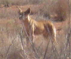
On this day we were entering Queensland, so lost half an hour out of the day. I think we set out a little after 9am. At 9.18 EST we came upon a dingo in a dry landscape:

Here’s the dingo in the bush on the right hand side of the track:


We thought the dingo was heading for our camp site to see if there were any scraps left behind.
On Day 4 we saw a lot of salt pans. On Day 5 not so many, mainly variations in the vegetation. Here the country was quite thickly covered:

Then we encountered the best example on the trip of a salt pan churned up by traffic in the wet:

And a closer look:

Then another dingo:


More landscapes:


Then morning smoko:


More landscapes:


Lunch on a clay pan:

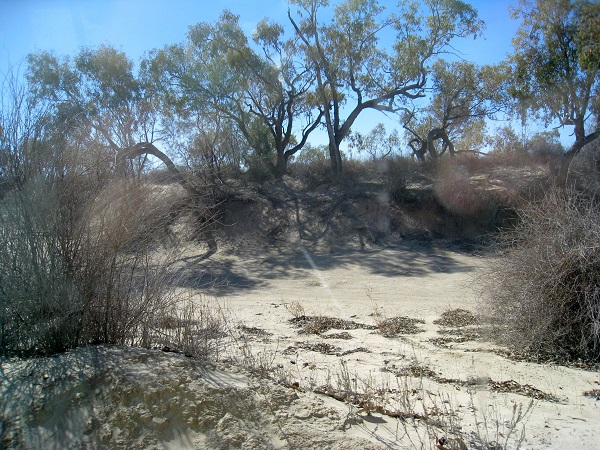
After lunch the interdune areas became grey and silty, rather than red. Then we came across the Eyre Creek, heavily incised into the inter-dune swale. Here’s a photo, actually taken soon after we met the walker (see below), but the periodic flooding explains the change in colouring and vegetation:

The next photo illustrates the marked change in landscape:


Here’s an example of a ‘dead’ tree growing again from the base:

About a day earlier, we had noticed some unusual animal tracks on the sand along the ‘road’. They mystified us for a while, but at one of our regular stops, Darral, our on-board expert animal tracker diagnosed the tracks as human, with the strange elongated trails indicating the use of two walking poles!
Eventually, we came upon the walker, a fellow who was walking across the Simpson Desert, apparently because it was there! (Note his walking poles on the ground).

We were told that he had a food and water supply system, with provisions dropped at arranged places. Initially, he had set out with a cart carrying the necessary supplies, but this had proved to be too difficult to push/pull through the sand. In our experience, he would have struggled to carry enough food for the trip. Water would have been impossible! He arrived at the Birdsville pub one day after we did.
More vegetation/landscapes:


We were getting near to Big Red when we stopped for some reason. Marion took a little walk. This is what she saw:


Foot prints in the sand, inter alia.
We were closing in on Big Red. I think this is the last sandhill before Big Red:

When we got there Don, our lead driver, had a go and failed. Here some of us are all ears, listening to a stranger also attempting to conquer Big Red:

The drivers met to pool their wisdom:

Yes, I’m there as an observer. The consensus was that Big Red had won. There was an easier way across to the south.
And yet, here is Len looking intently at the monster sandhill:

We’ll pick up the story there in the next post.
Note: This post is the ninth in a series on our Red Centre holiday.


Darral, as a person with an interest in animal tracks, what made the tracks that Marion photographed on her sojourn into the sand-hills?
Beautiful photos Brian and Co.
Have you calculated the carbon footprint of the trip, with all the diesel, gas ( fracked ?) camp fires ……..?
And were any sequestration activities ( tree planting…etc ) achieved along the way ?
I recon that would be very important info to visitors of Climate Plus.
Jumpy, I’m not in a position to do an accurate numerical energy audit of the our Simpson adventure, but here are some general thoughts.
Over the five days of the crossing, on the debit side, the 3 of us in our vehicle used:
* less than 90 L of diesel,
* about 2 kg of LPG for cooking,
* 4 bags of ice (to keep provisions cold), and
* 13 kg of firewood for a camp-fire.
On the positive side:
* we placed no call on the energy involved in operating the usual water and sewerage networks in our usual urban setting, and
* Our rooftop PV systems were pumping considerable extra electricity back into the grid (in my case, about 20 kWhr/day.
The firewood was used in a fire pit and lasted many hours, was able to be rekindled early the following morning …. it generated much social capital in the group. As well, the timber was sourced from outside the desert area.
But no, we didn’t plant any trees in the desert to offset our activities. Even if we had, they would sequester a remarkably small amount of carbon, such is the scarcity of resources for plant growth in this arid and infertile environment!
jumpy, what Len said. I would emphasise that we saved a lot of energy by not having showers and no heating of homes as against a fire on three nights only.
Len and Brian,
I’m not having a crack, just thought the footprint thing would be something you would would calculate.
If the trip were performed by someone for a profitable venture or as part of a companies activities I would expect demands from climate conscious folk for ” total emissions summery ” of there trips.
Say, for example, a gas exploration company surveying similar areas ( most of Australia )
Could be a useful.
No problem, jumpy.
Climate change seemed like a long way away. It was brought back to me with a jolt at Betoota, an abandoned town east of Birdsville. The sign said Population 0, Elevation 70m.
Keep doing what we are and in 1000 years or so the place will be under water!
You picked the wrong weekend Brian. 🙂
http://www.abc.net.au/news/2014-10-20/channel-country-ladies-day/5827062
jumpy, the Betoota Ladies Day was being advertised and we could see the buildings on the horizon. We were interested in the derelict pub, which closed in the 1990s when the road bypassed Betoota and killed it.
Hi Len
Despite our best efforts since returning home we have not been able to identify the foot prints. We consulted Professor Google long and hard, as well as some of our reference books (particularly Tracks, Scats and other Traces), as well as the results of a couple of surveys of “Animals of the Simpson Desert” but nothing was able to shed any light on them. There are a multitude of small nocturnal marsupials out there such as Dunnarts as well as various rodents. Most of these footprints were about the size of a finger nail.
A good reason to go back and have another look at them!!
They look like bird prints to me.
I’d guess animals.
Darral, the Night House in the Desert Park in Alice Springs had any number of small critters that live in the desert.
I’m sticking with the bird theory for the moment suggesting that the single mark is a beak plunge.
More research required.
Now that you are back and done camping for a while, it is a good time to have a look at an awesome cooking appliance that I have just learned about.
Google Cobb Cooker.
I’ve just had lunch and now I am hungry all over again just thinking about what one can do with this.
Hi Darral, Thanks heaps for your efforts. Maybe need to go back and look for scatological evidence as well?!
And BilB, The Cobb Cooker looks interesting – have you had it long?
I don’t have one, Len, but friends of my sister do, and they are keen campers. It came up because Icwas talking about a gas frypan I once had. The Cobb Cooker looks to me to be so much more versatile. I don’t know yet if they arestill or locally available.